Book a call


Imovirtual is one of Portugal’s leading real estate platforms, connecting property buyers and sellers nationwide. The “Maps & Locations” project aimed to improve one of the most critical parts of the property-search experience: understanding where a property actually is, what surrounds it, and whether it fits the buyer’s lifestyle and budget.
Through discovery research, benchmarking, ideation and usability testing, we designed a concept solution that clarifies property locations, enhances the map experience, and gives users stronger control when navigating listings and filtering by neighbourhoods and surroundings.

Users repeatedly reported difficulties identifying the exact location of a property. Hidden or approximate locations created mistrust, search results displayed properties outside the intended area, and the platform lacked detailed neighbourhood information. Buyers also struggled to understand what areas matched their needs—from safety and transport to green spaces and affordability.
The existing map was underused due to limited filtering options and unclear markers. Improving this experience was essential to increase clarity, trust, and navigation efficiency.
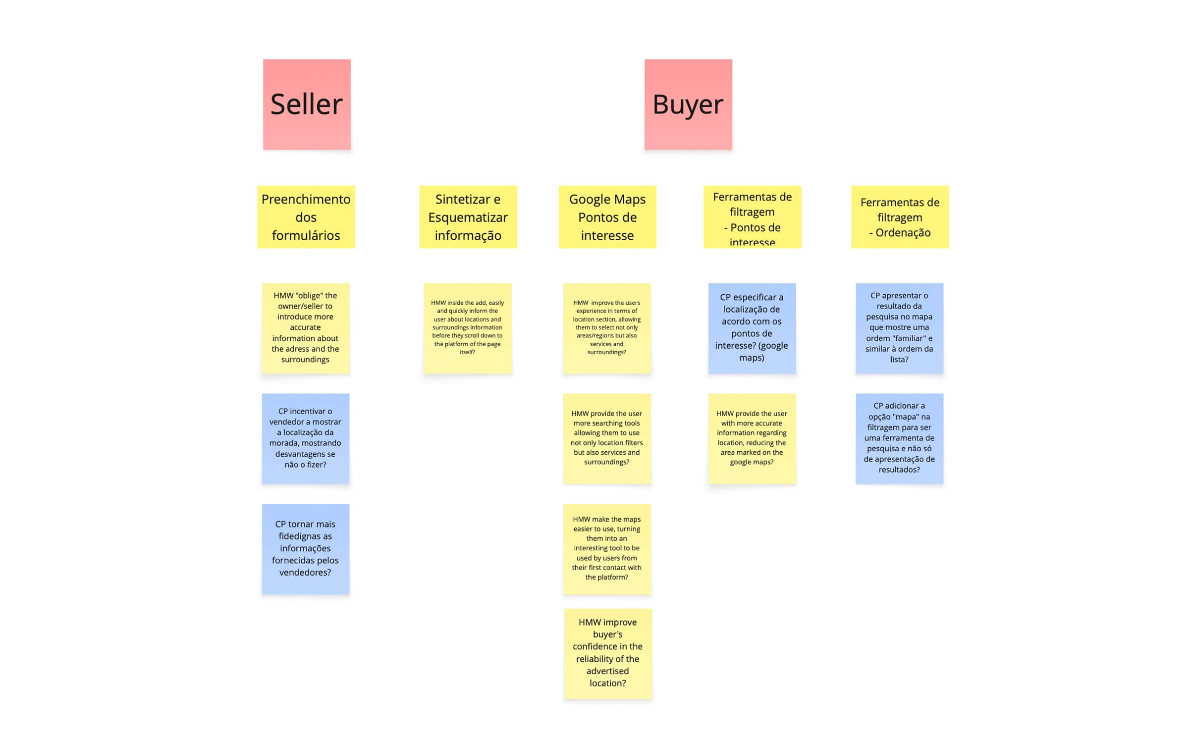
We began by analysing key user needs and frustrations, identifying core issues such as inaccurate locations, missing neighbourhood context, limited filtering, and the inability to search using unofficial neighbourhood names. Benchmarking platforms like Airbnb, Booking, Idealista, Trulia and Uniplaces helped us identify industry standards and gaps.
Using a structured problem-framing approach and How Might We statements, we explored solutions focused on precision, transparency and user control. These insights guided the design of a location-first experience supported by clearer map interactions, richer information architecture, and filtering tools that better reflect real-life property search behaviour.

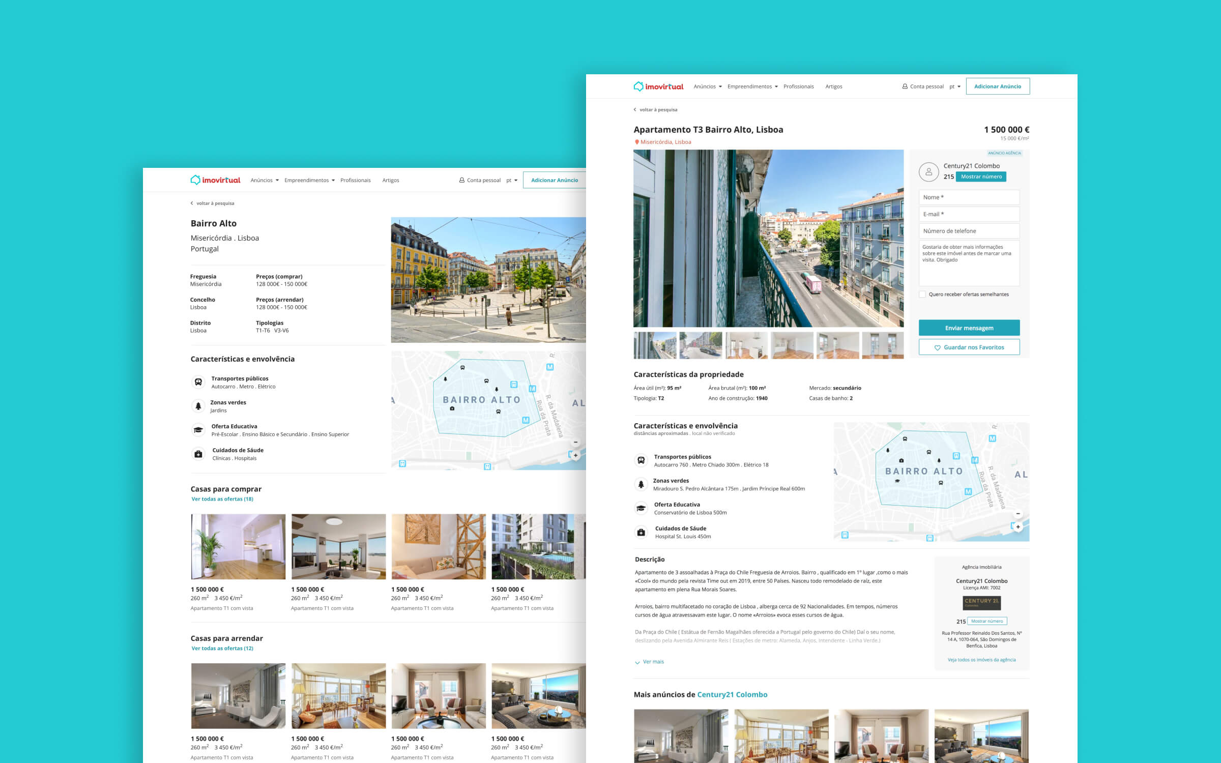
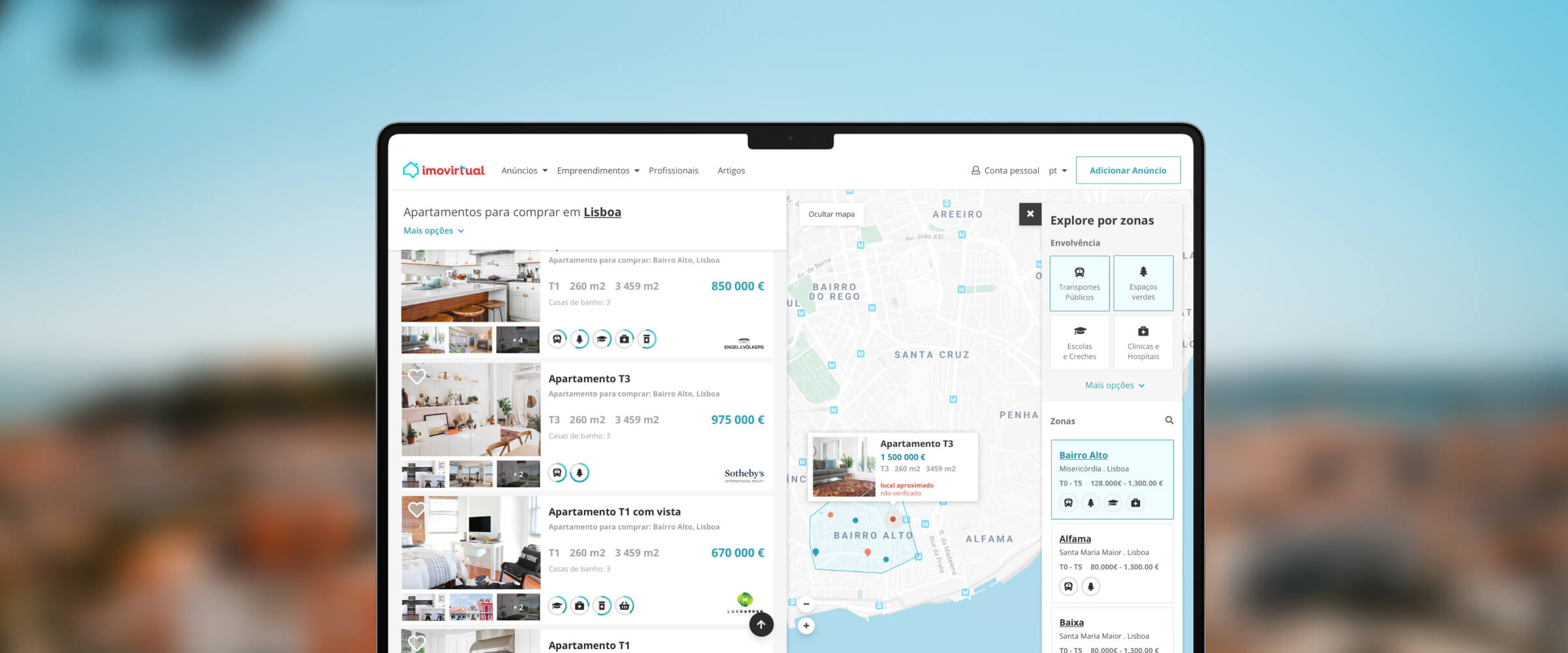
The redesigned experience introduces a clearer location system with distinct markers for exact, approximate, and verified locations. A refined map interface improves the connection between listing previews and pins, making it easier for users to understand where each property sits.
We introduced a new neighbourhood page containing relevant information such as local amenities, transport, safety, education, and green spaces—reflecting how many buyers begin their search. Filtering capabilities were expanded to include both “zones” and “surroundings”, giving users more granular control over the search experience.
These improvements were brought together in a high-fidelity prototype that reorganises the location experience around clarity, confidence and seamless navigation.

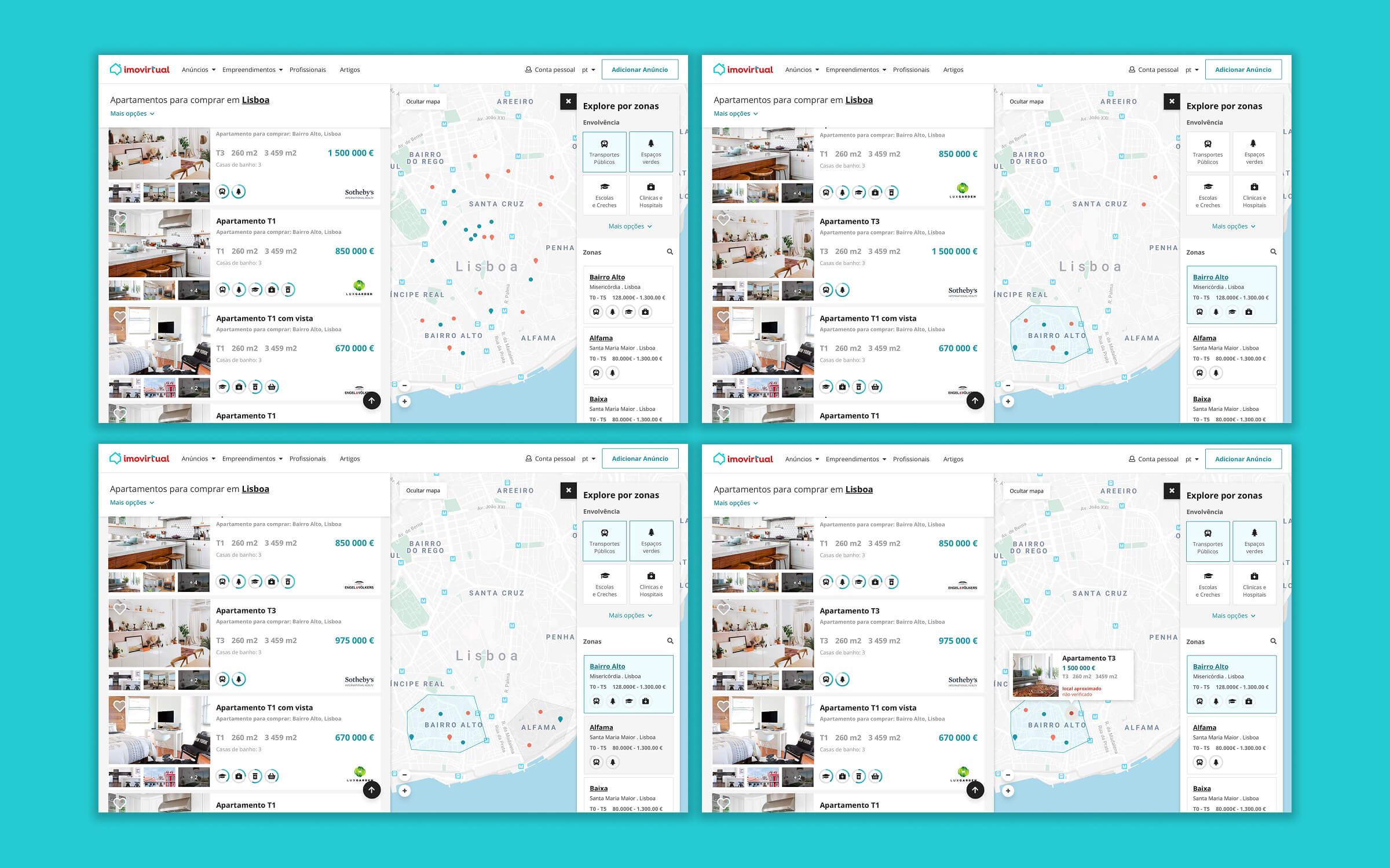
Usability testing validated key improvements across navigation, clarity and perceived control. The new filtering system for zones and surroundings was considered intuitive and highly relevant. The map + results dual-column layout helped users correlate listings with their exact or approximate locations more effectively.
The concept prototype achieved a 57% task-completion rate across all eight assigned tasks and a 90% error-free rate, based on Nielsen Norman Group’s definition of success rate.
Participants responded positively to the clarity of the new location categories. Neighbourhood pages generated enthusiasm and helped users make better-informed decisions early in the search.
The introduction of several new map markers highlighted the need for a legend to avoid ambiguity. Additional refinements, such as an “add zone” icon or improved listing preview indicators, were recommended to further support the user journey.
A redesigned property search experience focused on clarity, faster decision-making, and intuitive location tools — helping users find the right home with less friction.

A complex US-mortgage underwriting tool reorganised into clear flows, helping consultants review, validate, and approve applications with confidence.